This page is part of the Bearing Witness Project. It aims to visualize the destruction of the Gaza Strip over time. All of the contributors on this page (so far) have been Israelis living in Israel or abroad, who work on it out of a sense of commitment to human rights and responsibility for Israel's actions that are taken in our name. There is no funding involved. Like the broader project and report, we believe that accessibility and transparency ensure our project's persistence over time. As always, any comments are very welcome.
Data
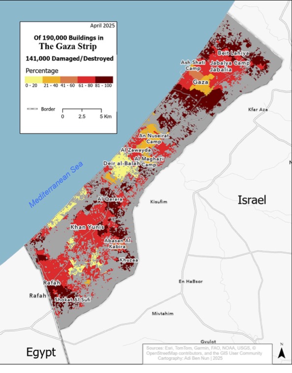
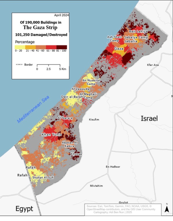
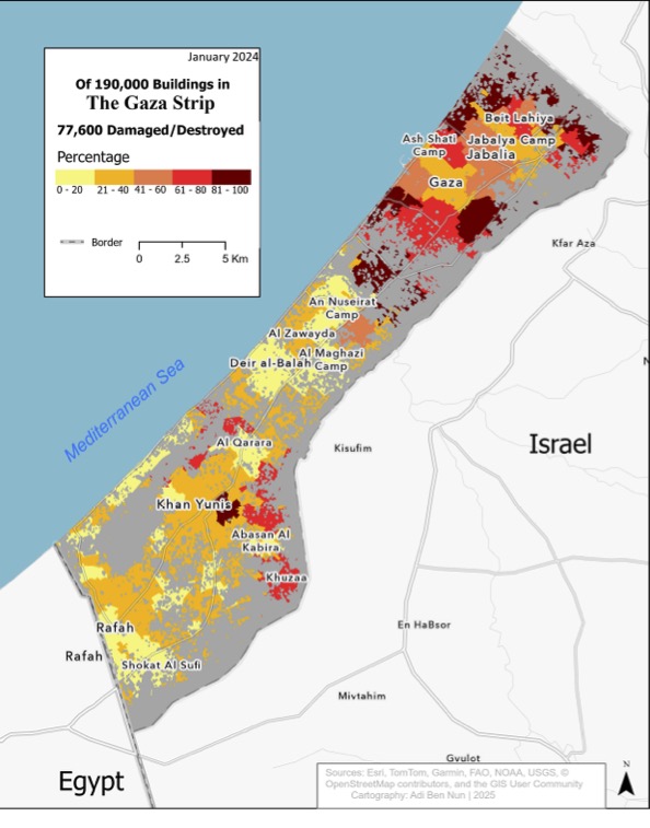
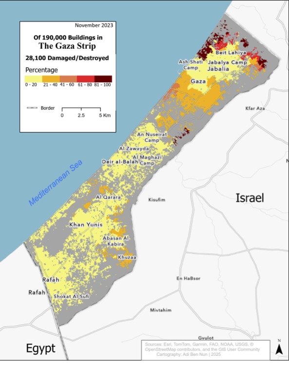
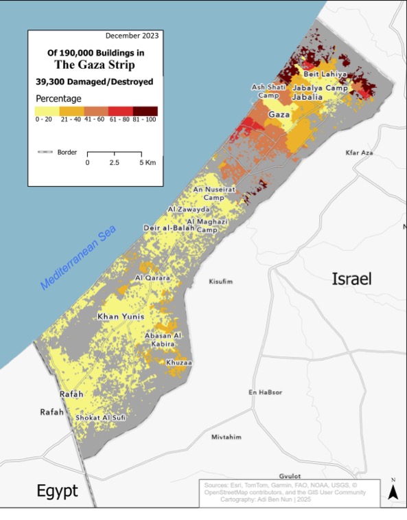
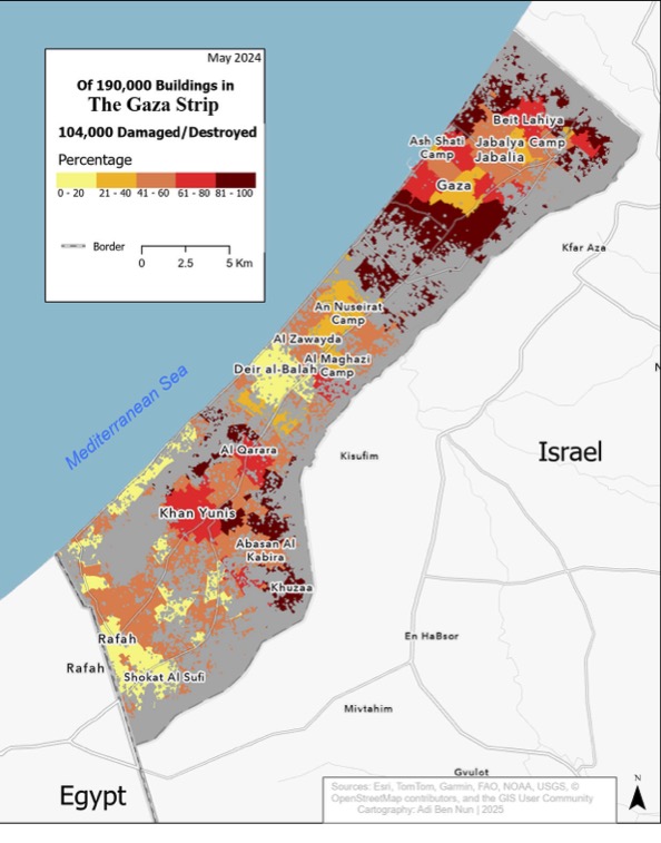
All the spatial data underlying the maps is open source and derives from UNOSAT, the United Nations' remote sensing service that records and analyzes the situation in the Gaza Strip periodically.
UNOSAT's maps and data (dates refer to the day in which the data was collected, not published):
Contributors
Adi Ben Nun, y.e.l, Lee Mordechai, Alon Steinmetz
We also thank all of those inside and outside the project whose comments improved this page.